The Trophy in the Middle of the River

by Jon Baliles

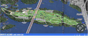
Some great news this week about the one thing most everyone can agree on: the James River is awesome, and the heart of the City just got a LOT more awesome. Or at least it is pointing in that direction. Mike Platania at Richmond BizSense reported that The Capital Region Land Conservancy (CRLC) is under contract to buy Mayo Island with the ultimate goal to create public green space. The “CRLC has made an initial security deposit on the island and is currently in the due diligence phase” and expects to close on the property next year.

“If successful … Mayo [Island], that has been long-discussed and long-envisioned for a public space, can now become that in the future,” CRLC Director Parker Agelasto said. “…Mayo is truly going to be the green space that everybody has been yearning for, with a nice walkability from the Hull Street corridor.”

Agelasto added that the CRLC is waiting to hear back from the Virginia Land Conservation Foundation about a grant it applied for that would help fund the purchase. The grant money would come from the state’s Community Flood Preparedness Fund.

“It’s not a guarantee,” Agelasto said. “[But] we feel very good about where we are at the moment.”

Amen to that. As the CRLC noted in its press release, this goal has long been in people’s dreams but never really close to reality — until now.Forty years ago the City of Richmond’s 1983 Master Plan noted ‘the conversion of Mayo Island into public open space is recommended due to its accessibility by City residents, including the handicapped, the availability of excellent fishing opportunities, and the potential for boating access’.”

Twenty-five years ago, in July 1996 the report “An Evaluation of Mayo Is Island for Potential Public Access for Recreation and Open Space Use” was issued. The acquisition of Mayo Island has been detailed in subsequent plans such as the Richmond Downtown Plan (adopted in 2009), Richmond Riverfront Plan (adopted in 2012), and James River Park Master Plan (adopted in 2019).

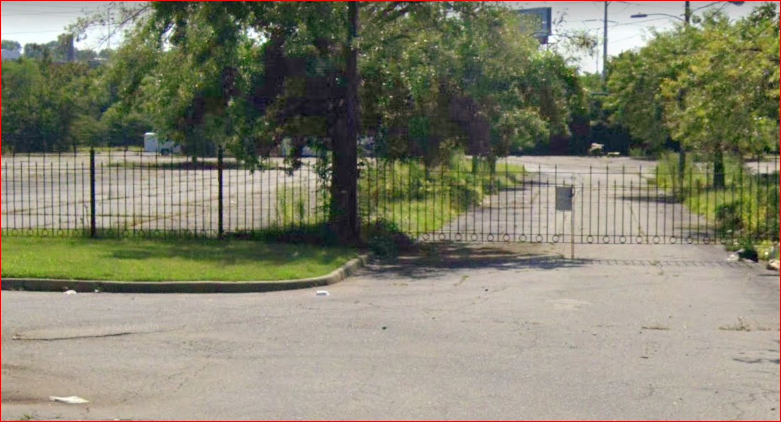
Agelasto told Colleen Curran at the Richmond Times-Dispatch that removing eight acres of asphalt will be one of the most vital tasks after the completion of the sale:

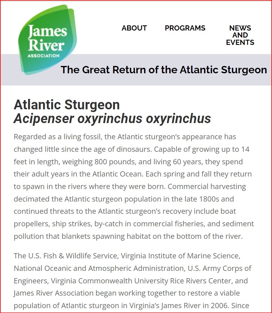
There is a heron rookery nearby and it’s where the sturgeon, shad and herring come to spawn. It has become an important place for natural wildlife in the heart of our city. It can also offer recreational opportunities when open to the public. It’s something that a lot of people have envisioned. Look at Belle Isle as an example of how walking trails can get people down to the river. Mayo Island is a very different part of the river, where people could fish, put in a paddleboard or canoe or kayak.

This is such great news it’s hard to quantify — but very easy to get excited because of the possibilities and what it will do to burnish and elevate even further Richmond’s reputation as a world-class outdoor city. If you recall the Mayo Island renderings in the Riverfront Plan from a decade ago, you start to see the possibilities and should be confident and eager to get going because with the CRLC leading the way and engaging with the City and the community, Mayo Island and its environs will be unlike any other park or space in America.

It’s a big, winning trophy with a blue ribbon standing tall, above all else, right in the middle of the James River, surrounded by water, rapids, trails, history, green space, people, and wildlife. And it’s freaking awesome.

***

The RTD has some great aerial photos of the island over the years that are definitely worth a look.

This report was first published by Jon Baliles on RVA 5×5. It is republished here with permission. 


Share this article


ADVERTISEMENT

(comments below)


ADVERTISEMENT

(comments below)


Comments

17 responses to “The Trophy in the Middle of the River”

  1. Stephen Haner Avatar
    Stephen Haner

    So this is the RGGI tax money, which funds the Community Flood Preparedness Fund? I scratch my head how developing this green space/brownfield prevents or mitigates flooding (or the real excuse they run to for this boondoggle, “sea level rise.”) Great idea for a park, but absolute proof the RGGI scheme is just about using tax dollars to make voting blocs happy, not “fighting climate change.” I guess removing the asphalt will prevent runoff.

  2. Stephen Haner Avatar
    Stephen Haner

    So this is the RGGI tax money, which funds the Community Flood Preparedness Fund? I scratch my head how developing this green space/brownfield prevents or mitigates flooding (or the real excuse they run to for this boondoggle, “sea level rise.”) Great idea for a park, but absolute proof the RGGI scheme is just about using tax dollars to make voting blocs happy, not “fighting climate change.” I guess removing the asphalt will prevent runoff.

  3. Stephen Haner Avatar
    Stephen Haner

    So this is the RGGI tax money, the carbon tax on electricity which funds the Community Flood Preparedness Fund? I scratch my head how developing this green space/brownfield prevents or mitigates flooding (or the real excuse they run to for this boondoggle, “sea level rise.”) Great idea for a park, but absolute proof the RGGI scheme is just about using tax dollars to make voting blocs happy, not “fighting climate change.” I guess removing the asphalt will prevent runoff, but if replaced with parking and sidewalks, no net benefit.

    1. Eric the half a troll Avatar
      Eric the half a troll

      There is a lot of parking there right now. I suspect shifting to park use will indeed be a benefit in terms of stormwater discharge.

  4. LarrytheG Avatar

    I’m pretty sure Mayo Island is below the 100 yr flood zone and has no water/sewer so would be better suited as a park however, money from a fund entitled “Community Flood Preparedness Fund” makes me wonder how Mayo meets the stated purpose of the grant.

    So, yeah, I’m agreeing with Haner here. This seems not an appropriate use of RGGI money and this will be used by opponents to show that it walks and talks like a boondoggle.

    And there is no question that Mayo Island as well as the bridge is going to get submerged some day, climate change or not.

  5. Bob X from Texas Avatar
    Bob X from Texas

    Mayo Island will make a great campground for hobos, homeless people, people temporarily experiencing homelessness, and bums.

  6. James Wyatt Whitehead Avatar
    James Wyatt Whitehead

    Remember the flood of 1942? I don’t but I heard so many stories about it I feel like I was there. State wide disaster. Mayo Island will flood again and again. Nearly 1/3 of Virgnia’s watershed is the James River. Better leave in the hands of mother nature. She will have her way.
    https://uploads.disquscdn.com/images/4349faed45fa2bd6861b282589145f8abbb2193fd39ee18665f5b942ce4da521.jpg

    1. You do mean 1972, right? Agnes?

      I remember Agnes in 1972, but I was not in Richmond. I lived n Virginia Beach where we had our own problems. I only saw the flooding in Richmond on the TV, but it was impressive.

      1. James Wyatt Whitehead Avatar
        James Wyatt Whitehead

        1904, 1911, 1937, 1949, Each generation is treated to memorable flood. 1942 was widespread. Wiped out a great number of the old fashioned iron trestle bridges on major roadways.

        1. I have no doubt the 1942 flood did those things. However , the all-time worst flood in Richmond may have been in 1777. Due to a lack of data, that flood cannot be precisely measured or compared to more recent events.

          Then there is Agnes in 1972, which is the worst flood since records began being kept in 1816.

          The flood of 10/17/1942 had the 16th highest crest on record at 19.80 feet.

          For the period of record (1816 to present) the top ten worst floods in Richmond are, in order of maximum crest height (ft):
          06/23/1972 – 28.62; 08/21/1969 – 24.95; 11/07/1985 – 24.77; 03/19/1936 – 23.42; 04/27/1937 – 22.65; 04/18/1987 – 21.91;
          08/18/1940 – 21.80
          09/20/1944 – 21.80; 10/07/1972 – 21.76; 09/08/1996 – 21.23

          The data indicate a total of 193 floods of Stage 12 or higher during the period of record. That’s one flood every 1.07 years.

          Your point is well made. Mayo Island should probably be allowed to return to a wild state.

          Flood Category (by crest height):
          Minor = 12 ft to 14.99 ft
          Moderate = 15 – 21.99 ft
          Major = 22 ft or greater

          * Primary data source is records from Henrico Stream Gage located at
          Lat: 37.563; Long: -77.547

  7. LarrytheG Avatar

    “The City of Richmond’s Riverfront Plan, a long-term package of improvements along the James River that would cost about $60 million, envisions turning the island into a park. The idea of a Mayo Island Park was also discussed as part of the Downtown Master Plan and in earlier city discussions.

    Shaia said he thinks the land is best suited for development. He noted that the city has “many, many acres of parks” already, including Belle Isle just upriver. He said one option could be to develop part of the land and create a park on another.

    Most of Mayo Island is below the 100-year flood line, which makes zoning changes, especially for potential residential development, difficult from a regulatory standpoint.”
    Commercial development, according to the plan, would require building a secondary access route to the island that is higher than the current bridge and above the line of the 100-year floodplain. The island is not connected to the city’s sewer system.”

    and yet, a street view shows this commercial building which almost surely had bathrooms:

    https://uploads.disquscdn.com/images/a0b7716ed8438bc6b751dfb3504e76fd9e59f93eae7468f052862ccdb9046518.jpg

    https://uploads.disquscdn.com/images/7f5e326f36444a6ec29a9def65fb5d6e88ca2fde2906952016a3b227c572e617.jpg

    1. Stephen Haner Avatar
      Stephen Haner

      A park which is designed intentionally to be inundated from time to time is the only logical use. But doing that won’t “mitigate” anything downstream and it makes no sense to spend flood control dollars to develop a park. Better uses for those dollars should be found.

    2. Stephen Haner Avatar
      Stephen Haner

      A park which is designed intentionally to be inundated from time to time is the only logical use. But doing that won’t “mitigate” anything downstream and it makes no sense to spend flood control dollars to develop a park. Better uses for those dollars should be found.

  8. LarrytheG Avatar

    The bigger and more significant costs of a “park” (or other facility that is intended to be used by the public – as opposed to set aside and just “preserved” – eg a Conservation Easement or equivalent), is not the initial acquisition of the land but the follow-on daily/weekly/annual operation and maintenance costs.

    Simple things like maintaining trails, sanitation (bathrooms) , and security cost money on an ongoing basis. If there actually is an in-place financial plan to operating a prospective park then good on them (despite the fact it is a designated flood zone which means cleanup, repairs, rebuilding costs also).

    If there is no financial plan, it’s problematical and the folks that provide such grants should preclude any grant award for something that does not have a follow-on O&M plan because the money will essentially be wasted/squandered on a facility that will ultimately be abandoned or one that stays in continuous disrepair for lack of funding.

    For me, this is not about RGGI per se (Haner’s thing) but rather ANY grant-awarding entity with regard to using grant money to purchase land that is not being contemplated to be set aside and will incur ongoing O&M costs.

    Virginia State parks have this issue. They can get the land fairly easily, often by donations of estates but once the land is developed into a park facility, there are costs, and Virginia State Parks have no additional money other than what the GA chooses to give them over and above prior year funding… and that funding is not one-time, it’s a permanent increase incurred in the state budget.

    Organizations like the American Battlefield Trust or the Nature Conservancy that do acquire land but choose to set it aside to preserve in place rather than turn it into a public-use “park” that requires annual O&M funding.

    Even setting land aside can incur annual costs of just trying to maintain the land – for instance to prevent activities like use by off-road vehicles, target shootings, etc.

    Both the ABT and NC (and other such “preservation” orgs) also try to focus their efforts on properties that have “significance” , historical, recreational, cultural and a Federal, State or Local government will take procession of the land and fund the continuing O&M needs.

    Seems like Richmond has had “plans” for Mayo off and on so perhaps they are in the picture at some point beyond wishful thinking.

    Right now “access” to the more natural parts of Mayo Island look like this – which will keep out most law-abiding folks but not the feral types:

    https://uploads.disquscdn.com/images/a1a6e3bc2a33b2084b67cc2335489ac26e0915ac9395b9220a7105cb8c154226.jpg

    https://uploads.disquscdn.com/images/7e56e12051fe500dc881a6595da8c99a5ce2925892789fb98a0396153f0f3f7f.jpg

  9. DJRippert Avatar

    “Mayo Island is a very different part of the river, where people could fish, put in a paddleboard or canoe or kayak.”

    Hopefully, the fishing does not include keeping American shad.

    https://www.virginiamercury.com/2021/11/17/american-shad-on-brink-of-collapse-in-james-river-says-conservation-group/

    1. LarrytheG Avatar

      and yet…..

      https://uploads.disquscdn.com/images/04be7a92066788a78508098203adec605c650909e2e20e20d309a38ad65ad3a4.jpg

      https://thejamesriver.org/great-return/

      Now I have to ask you given your dislike of govt… is this something the govt should not be involved in and leave it to more competent players?

    2. I’d like them to explain how the ability to “fish, put in a paddleboard or canoe or kayak” makes Mayo Island a “very different part of the river”. There are numerous places where those activities can be engaged in along the James River.

Leave a Reply