We’re all familiar with the housing crisis, and we’re all familiar with the transportation crisis. And readers of this blog understand that the two phenomena are hopelessly entangled because many households seeking less expensive housing are willing to trade longer commutes for lower mortgages.
To gauge a region’s livability, one cannot consider the affordability of housing in isolation. It is far more meaningful to analyze the cost of housing and transportation together. That is the purpose behind the Housing and Affordability Index created by the Center for Neighborhood Technology for 52 major metropolitan regions around the country.
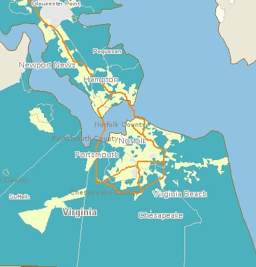
The map above shows in blue the parts of Hampton Roads where housing/transportation is unaffordable (consuming more than 48 percent of area median income). The map below displays Northern Virginia.
Visit the Housing & Affordability Index website here to view other metro areas and experience the full functionality of the mapping tools. (Hat tip to Jonathan Mallard, who referred me to a post on Buttermilk & Molasses.)
